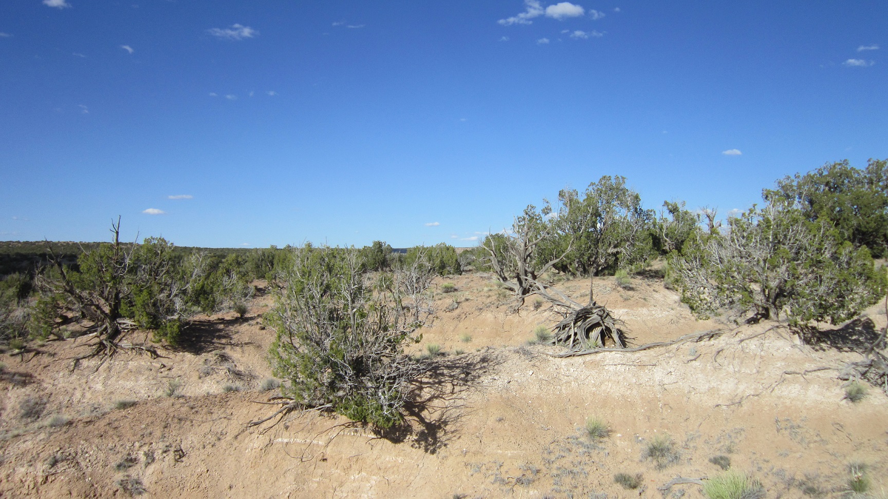


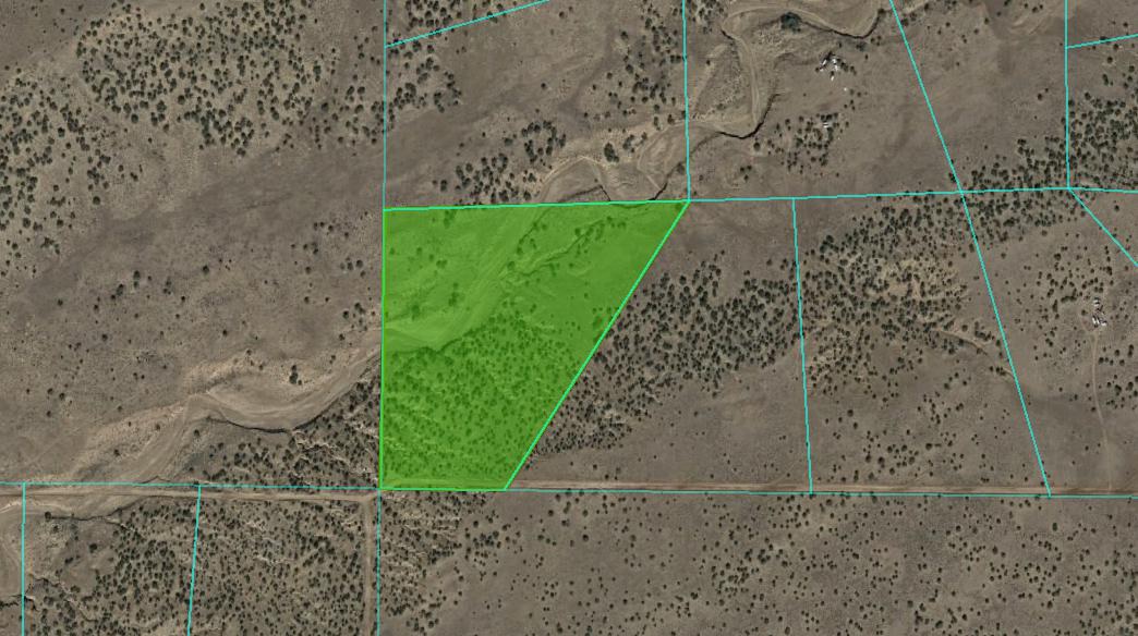
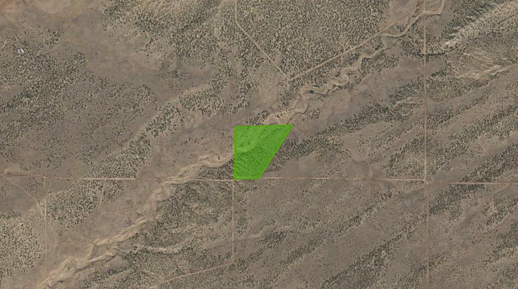
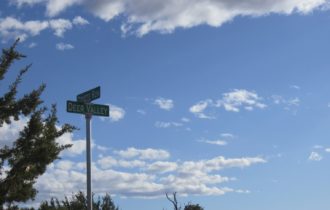
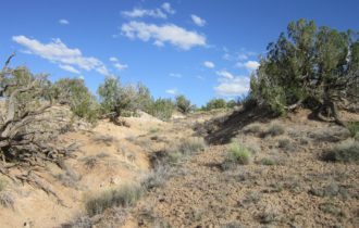
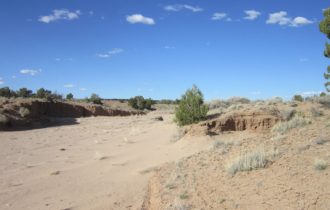
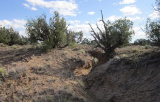
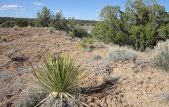
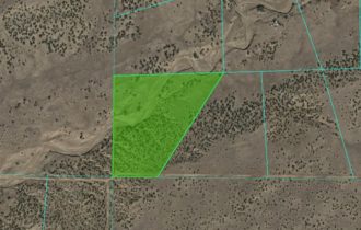
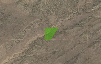
36 acres in Apache County, Arizona. Surround yourself with endless opportunities for outdoor adventure. (Deer Valley Rd 2)
Payment Options
Payment Note(s)
If you are interested in reserving this parcel, click the “Buy Now” button above. You will be redirected to our payment page to make your down payment.
Description
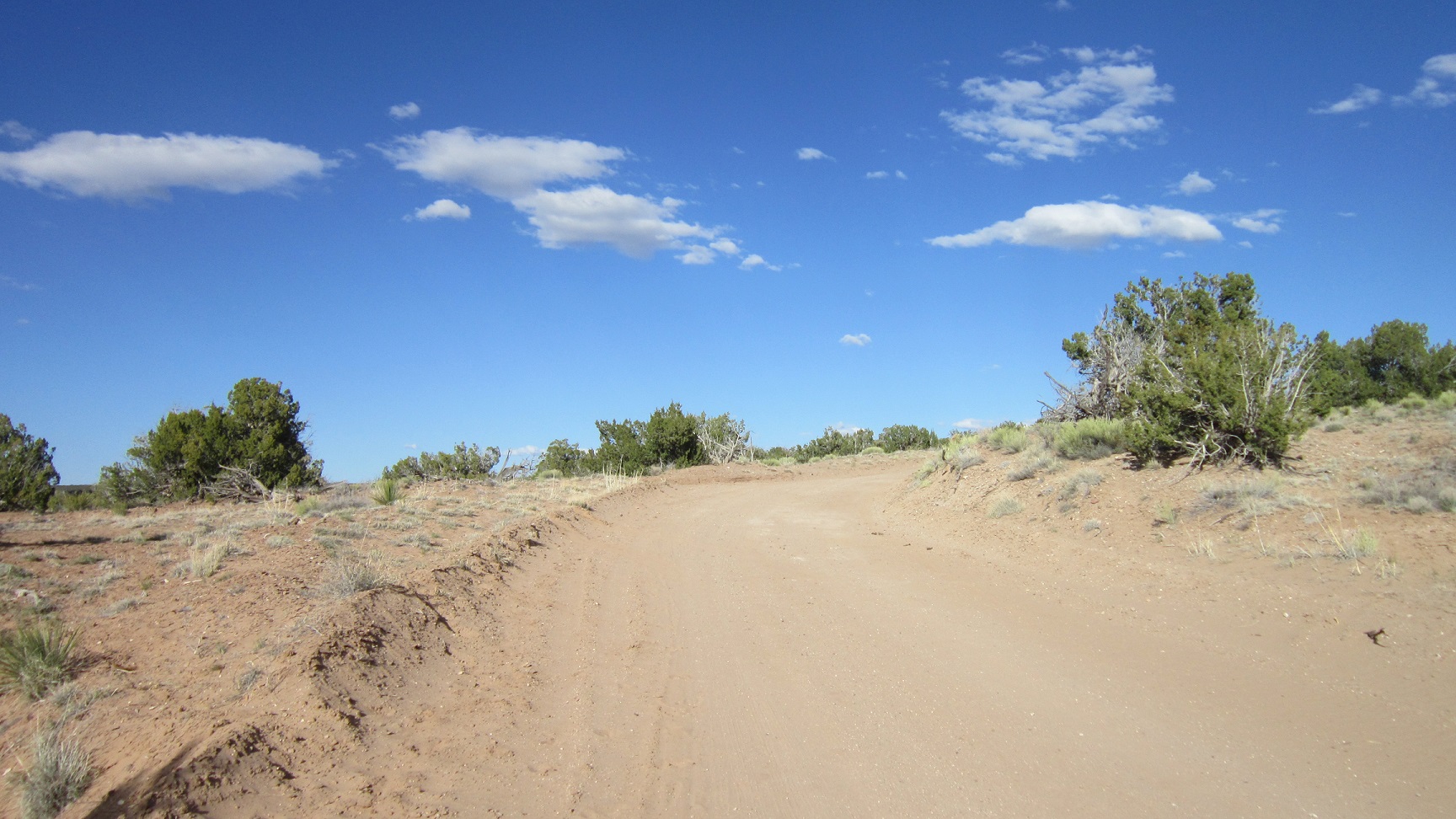
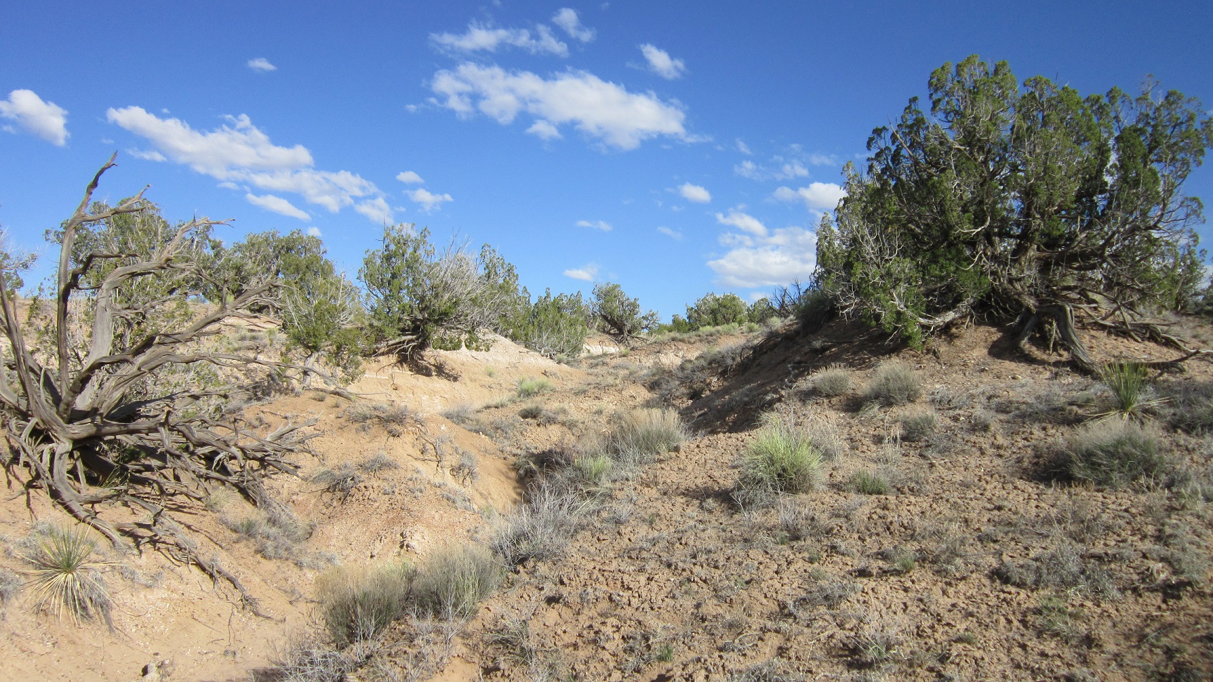
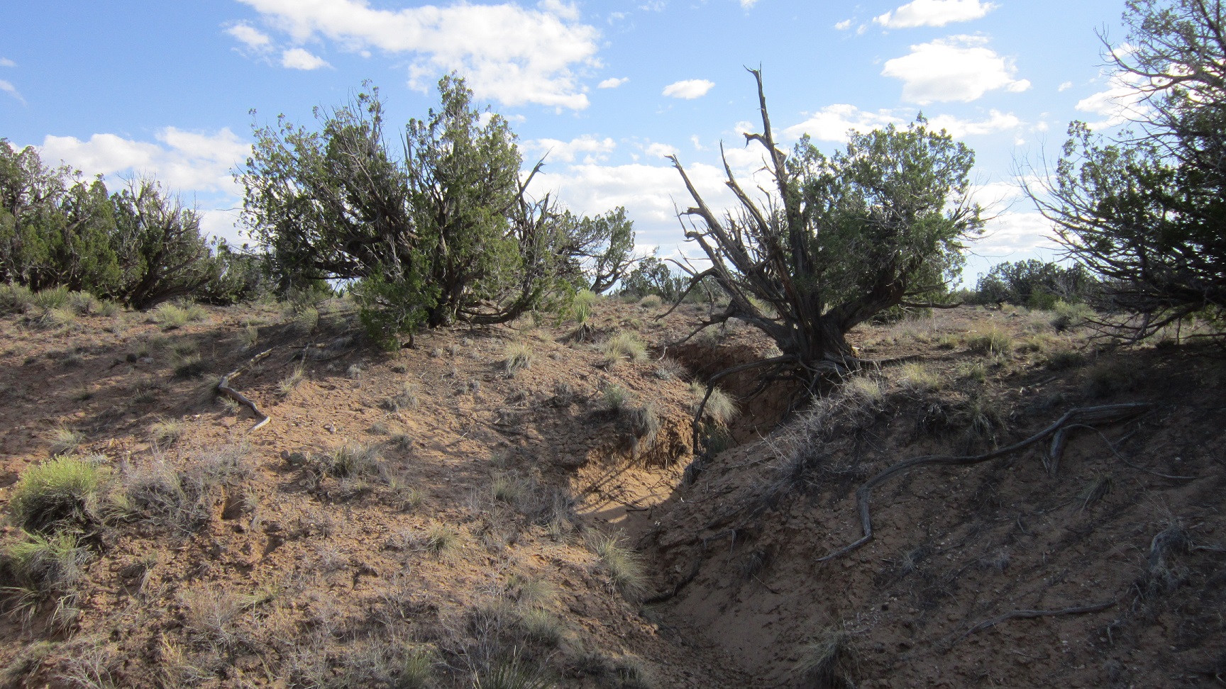
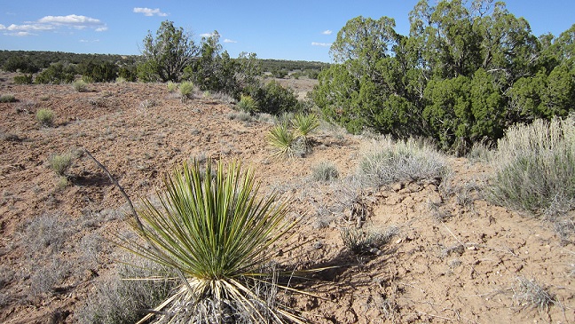
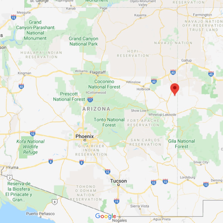
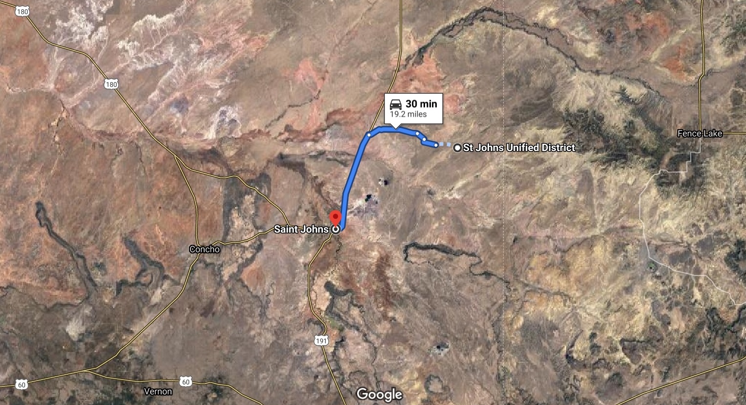
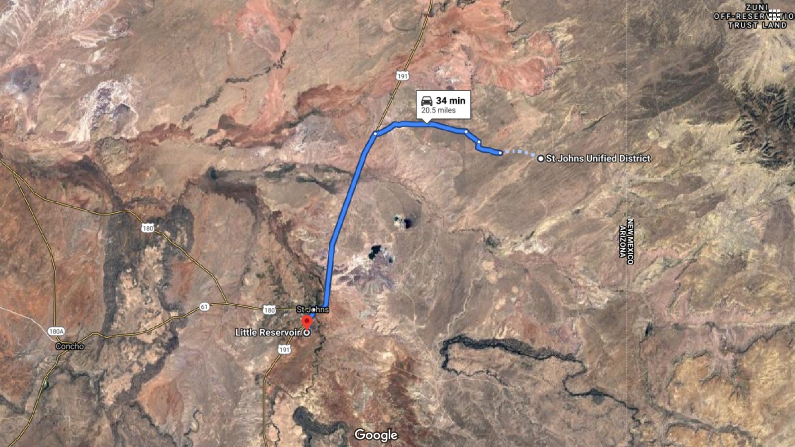
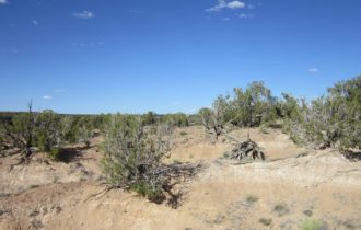
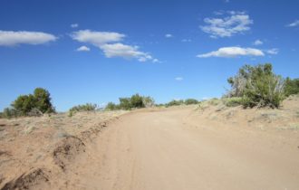
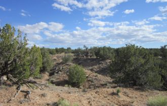
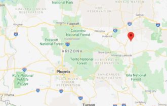
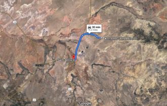
This spacious property is located in northern Arizona – an area that offers tremendous freedom to do what you like on your own land. Escape from nosy neighbors and live the life you’ve been dreaming of. Turn this slice of wilderness into your private basecamp for year-round outdoor recreation. A twenty-mile drive brings you to St. Johns to stock up on supplies. The local property owner’s association maintains nearby roads for easy access and provides a community well for your water needs.
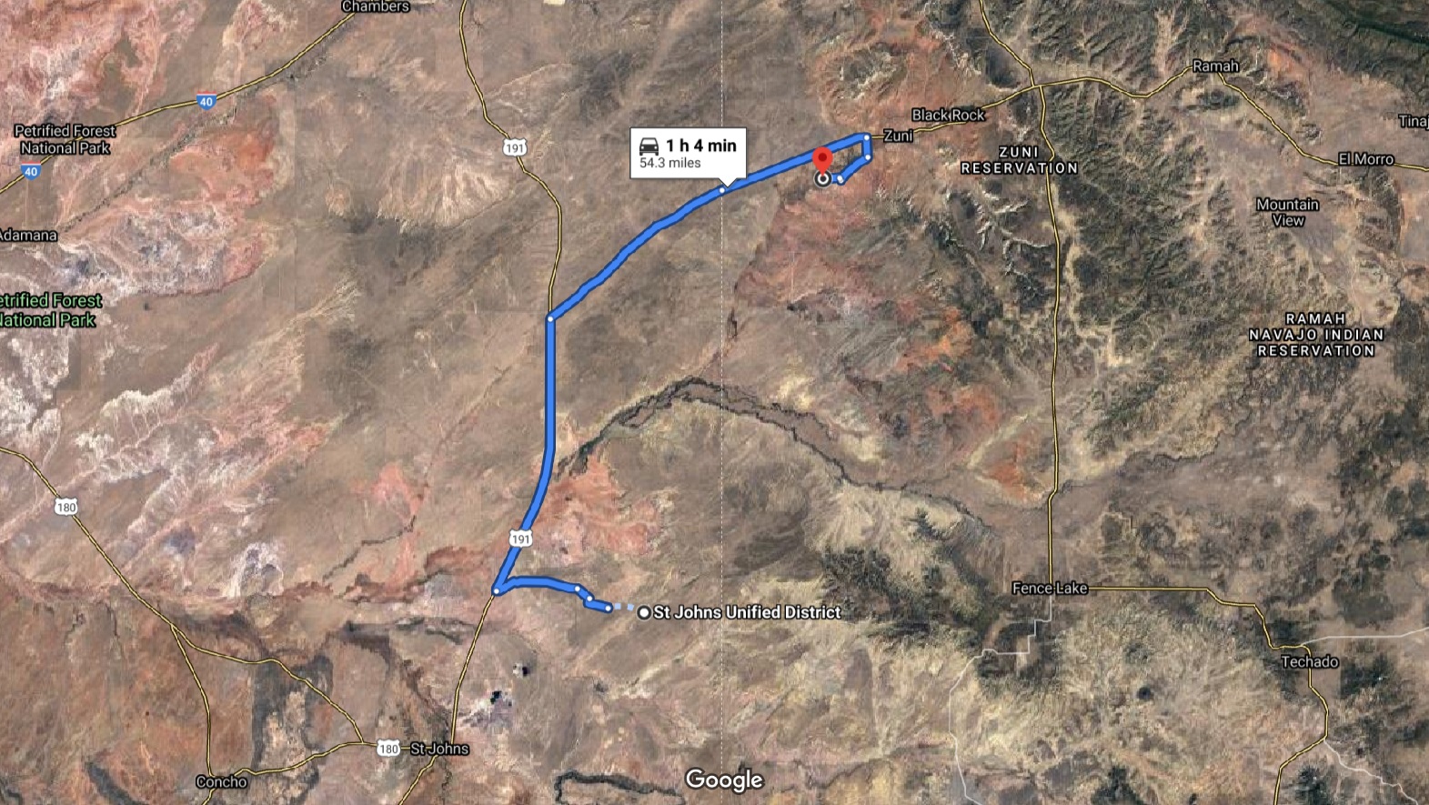
Once you’re geared up, visit Lyman Lake State Park on the Little Colorado River for swimming, boating, and hiking. Hunt White Mountain, explore red-rocked backcountry on your ATV, or soar above stunning landscapes by zipline. Nearby Sunrise Ski Resort offers 65 runs over three mountains and separate snowboarding, cross-country ski trails, and more. Purchase your piece of paradise today!
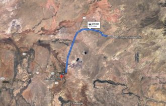
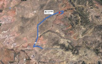
9 miles to St Johns; 32 miles to Lyman Lake State Park
OWNER FINANCING AVAILABLE. No credit checks.
THE FACTS:
Acerage: 36 acres
Terrain: Generally flat
General Elevation:
Sewer: Septic
Water: Well or Cistern
Electricity: Solar
Parcel #: 204-61-539
GPS: 34.631660, -109.136154
Taxes: $120/year
Conveyance: Warranty Deed
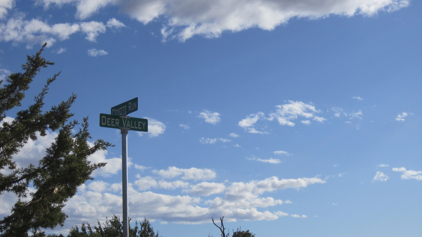
Property Owner’s Association: Woodland Valley Ranch
THE TERMS:
Down: $1,000
Price: $14,995
Monthly Payment: $284 (5 years) + $9 monthly processing fee & property taxes & POA fee (if applicable)
Please contact Apache County directly for land use rules: 928-337-7526
(Deer Valley Rd – 2)
Property Information
Parcel Size
36 acres
State
Arizona
County
Apache
Nearest Cities
St Johns
Parcel #
204-61-538
Address
Deer Valley Rd
Legal Description
Parcel No. 539, WOODLAND VALLEY RANCH UNIT IV, being a portion of Section 11, Township 14 North, Range 30 East of the Gila and Salt River Base and Meridian, Apache County, Arizona, according to Book 8 of Land of Surveys, Page 185, records of Apache County, Arizona. EXCEPT one-half of all oil, gas and oil and gas rights and other hydro carbon substances and rights therein, as reserved in instrument recorded March 3, 1941 in Book 26 of Deeds, Page 230; and EXCEPT one-half of all oil, gas, and oil and gas rights and other hydro-carbon substances and rights therein, as reserved in instrument recorded February 28, 1941 in Book 26 of Deeds, Page 231 and in instrument recorded in Book 41 of Official Records, Pages 94-97; and EXCEPT an undivided 1/32nd interest in and to all minerals and mineral interests in, on, under and to be produced from said land as conveyed in deed recorded in Docket 246, Pages 353-354; and EXCEPT an undivided 1/32nd interest in and to all minerals and mineral interests in, on, and under and to be produced from said land as conveyed in deed recorded in Docket 246, Pages 355-356; and EXCEPT all minerals, oil and gas as reserved in deeds recorded in Docket 260, Page 263, Docket 260, Page 368 and in Docket 303, Page 119; EXCEPT that portion of said reserved minerals, oils and gas conveyed to Earl Platt and Buena Platt, husband and wife in deed recorded in Docket 304, Pages 411-412; and EXCEPT all rights, title and interest in and to all geothermal resources, all hydrocarbon and substances and gasses, and all minerals including without limitation as such term is used in the Stock Raising Homestead Act of December 29, 1961 (43 U.S.C. 291-302) and specifically excluding sand and gravel, and rights incident thereto, as reserved in deed recorded in Docket 956, Pages 404-418. Note: Deed covers other property. River Base and Meridian, Apache County, Arizona, according to Book 8 of Land of Surveys, Page 185, records of Apache County, Arizona. EXCEPT one-half of all oil, gas and oil and gas rights and other hydro carbon substances and rights therein, as reserved in instrument recorded March 3, 1941 in Book 26 of Deeds, Page 230; and EXCEPT one-half of all oil, gas, and oil and gas rights and other hydro-carbon substances and rights therein, as reserved in instrument recorded February 28, 1941 in Book 26 of Deeds, Page 231 and in instrument recorded in Book 41 of Official Records, Pages 94-97; and EXCEPT an undivided 1/32nd interest in and to all minerals and mineral interests in, on, under and to be produced from said land as conveyed in deed recorded in Docket 246, Pages 353-354; and EXCEPT an undivided 1/32nd interest in and to all minerals and mineral interests in, on, and under and to be produced from said land as conveyed in deed recorded in Docket 246, Pages 353-356; and EXCEPT all minerals, oil and gas as reserved in deeds recorded in Docket 260, Page 263, Docket 260, Page 368 and in Docket 303, Page 119; EXCEPT that portion of said reserved minerals, oils and gas conveyed to Earl Platt and Buena Platt, husband and wife in deed recorded in Docket 340, Pages 411-412; and EXCEPT all rights, title and interest in and to all geothermal resources, all hydrocarbon and substances and gasses, and all minerals including without limitation as such term is used in the Stock Raising Homestead Act of December 29, 1961 (43 U.S.C. 291-302) and specifically excluding sand and gravel, and rights incident thereto, as reserved in deed recorded in Docket 956, Pages 404-418.
Features
Acres
36
County